

Price :
QTY :
CART TOTALS :
There are items
in your cart
CART TOTALS :
With this products also buy:
Your shopping bag is empty
Go to the shop
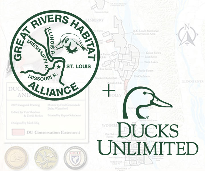
GRHA looks for ways to partner on habitat both within the Confluence and up-river partnering with others on watershed projects (public and private) upriver in Illinois, Iowa, Minnesota, and Wisconsin to address habitat loss and flooding. Great Rivers Habitat Alliance has made a commitment to partner with Wisconsin Ducks Unlimited and other partners to support Wisconsin’s Big Rivers Initiative.
The Wisconsin Big Rivers Initiative focuses on the western two-thirds of the state that drains into the Mississippi River, down to the Confluence and eventually the Gulf of Mexico.
Historically, small pothole-type wetlands created by the Wisconsin glaciation were a dominant feature of the state’s landscape; however, agriculture and urban development have resulted in a loss of more than half of the state’s original wetland resources and fragmentation of surrounding grasslands has increased sediment and nutrient loading in area streams, rivers and lakes. Loss of wetland habitats also increases the volume and velocity that these water race to and down the Mississippi River.
DU has been working in the Mississippi River Watershed since the late 1980s and has accumulated extensive knowledge and valuable experience in managing this system. They make the perfect partner for GRHA to work within this watershed. The goal is to maintain and improve the productivity of this key waterfowl area which in turn will decrease sediment and water loads in the Mississippi River as well as provide public recreation opportunities.
The Wisconsin Big Rivers Initiative provides a mechanism for GRHA to partner with Ducks Unlimited, the Wisconsin Department of Natural Resources, the US Fish and Wildlife Service, and other non-governmental organizations to work cooperatively with public and private partners to prioritize and deliver projects in a highly efficient manner. This team meets annually to develop an extensive list of projects that are initiated based on available funding and importance. Several of these “future” projects are now ready for delivery based on completed survey and design work, and with GRHA’s investment—both direct and as a match for public source dollars, the partnership can get these projects on the ground.
Mississippi River Watershed Program
Mississippi River Watershed Program Restoration of wetlands and associated grasslands within the Mississippi River watershed is needed to reduce nutrient and sediment inputs into the river system and to increase habitat for breeding and migrating waterfowl and other wildlife. The Mississippi River Watershed Program is a landscape-scale approach to habitat improvement that restores degraded wetlands and upland habitat within a matrix of agricultural lands to buffer and support the highly productive core habitat areas. This landscape-scale mix of agricultural land, grasslands and wetlands is the key to long-term wildlife populations and watershed health.
Since presettlement times, the area within the Watershed has lost 99% of its prairie and savannah and over 50% of its wetlands.

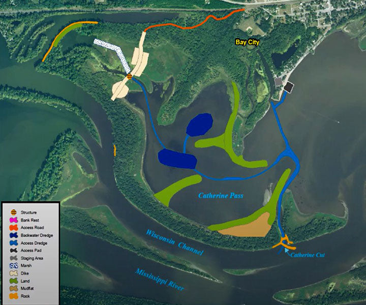
Project Highlight: Lake Pepin, Pool 4, Mississippi
The US Army Corps of Engineers is leading an audacious, $24 Million, remediation of Lake Pepin. Pool 4 is an impoundment of the Mississippi River resulting from the construction of Lock and Dam 4 in 1935 as part of the navigation channel project. Pool 4 is 44.2 miles long, extending from Red Wing, Minnesota at River Mile 797 to Alma, Wisconsin at River Mile 753.
Lake Pepin, a large river lake, is entirely contained within Pool 4 of the Upper Mississippi River. The average depth of the lake is 21 feet, and the maximum depth is 60 feet, though water depths throughout much of Upper Lake Pepin are less than five feet. Lake Pepin forms the boundary between Minnesota and Wisconsin and covers 29,000 acres. Within Upper Pool 4, the 6,500-acre Pierce County Islands Head of Pepin Backwater Complex extends 8 miles and includes backwater lakes, sloughs, flowing channels, and islands. Almost 1,000 acres are designated as the Pierce County Islands Wildlife Management Area. Pre-impoundment, the Pierce County Islands were a mixture of bottomland forest, permanent and seasonal lakes and forested wetlands, wet meadow and sloughs that conveyed flow seasonally. Impoundment did not greatly affect backwater and off channel areas within the Pierce County Islands Head of Pepin Backwater Complex. This was due to the distance from Lock and Dam 4, which is over 30 miles downstream. Water depths are variable throughout the area with deepest depths associated with the main channel of the Mississippi River and a larger secondary channel called the Wisconsin channel.

Backwater depths are generally shallow and are decreasing over time due to long-term effects of sedimentation. The river ecosystem in Upper Pool 4 has been significantly affected by sedimentation and degraded water quality associated with high suspended sediment concentrations. Concerns over habitat deficiencies in Upper Pool 4 include reduced habitat diversity and quality, lack of aquatic vegetation and invertebrates, and reduced abundance of fish and wildlife.
Specifically, the major concerns are as follows:
DU’s engagement is the inflection point to a robust, landscape level, conservation plan in the Mississippi River watershed mimicking our success building off the US Army Corps’ Cat Island restoration in the Bay of Green Bay. Because of our expertise, the unlimited opportunity to provide outcomes for waterfowl and people up the watershed, the generosity of private funders, and the availability of state and federal match programs like the Great Lakes Restoration Initiative; DU impacts thousands of acres annually in Northeast Wisconsin. There is a significant role for DU in this partnership in Southwest Wisconsin to provide expertise as it relates to waterfowl habitat within the project boundary, but more importantly to work up the watershed.

Proposed Project: Protecting Critical Habitat at the Richard Bong State Recreation Area… for the Benefit of Wildlife and People
Ducks Unlimited, in partnership with the Bong Naturalists Association (BNA), has identified an urgent opportunity for protecting critical habitat on land adjacent to the Richard Bong State Recreation Area in Kansasville, Wisconsin (Kenosha County). This conservation project addresses a true, immediate threat of losing public access land and the wildlife habitat connectivity it supports
The WI Big Rivers Initiatives immediate goal is to purchase and hold the land, with the long-term plan to donate it to the Wisconsin Department of Natural Resources (DNR) to incorporate into the Richard Bong State Recreation Area. The acquisition will secure this important property for the public, expand the recreational area’s footprint and preserve wildlife habitat.
Its wetland and hardwood forest also serve an important role in protecting the watershed of Wolf Lake and the Des Plaines River with tremendous sustainability impacts.
Sustainability Outcomes*

*Please note, of the 132.8-acre parcel, 106.3 acres are zoned either A-2 (General Agricultural District) or C-2 (Upland Resource Conservancy District) and are at some risk of development or conversion to agriculture (including the wetlands and shoreline district which have the potential to be developed if mitigation is performed). The area zoned PR-1 (Parks and Recreation District) was excluded from this analysis.
Ducks Unlimited has asked the Great Rivers Habitat Alliance to play a pivotal role in protecting and expanding Wisconsin’s Big Rivers Initiative by partnering with DU on these and other efforts.
With DU’s extensive partnerships and leveraging ability, they anticipate that financial support from a GRHA will be leveraged at least 3:1
GRHA Partners with Ducks Unlimited in many ways including the DU Conservation Easement Program. GRHA partners in the Conservation Easement Program increase the uptake of private conservation easements by providing landowners financial support during the due diligence process and by promoting the overall program. These easements preserve the land in perpetuity, with a goal of eventually assembling enough parcels to effectively create a wall of protection against commercial development in the Confluence.
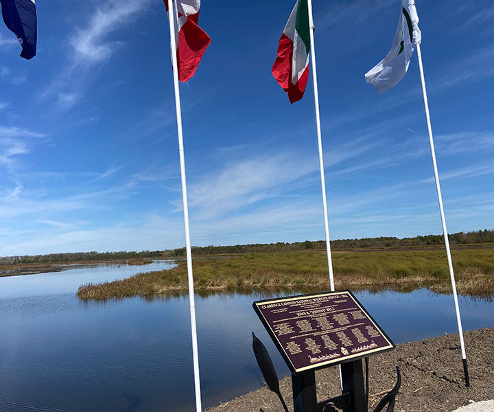
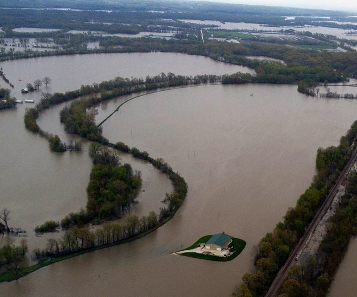
GRHA partners with Ducks Unlimited and other partners on projects addressing wetland loss and flooding within the Confluence through DU’s Big Rivers Initiative -Missouri. The Confluence of the Mississippi, Illinois, and Missouri Rivers is North America’s greatest floodplain forming a unique wetland system known as the Confluence Floodplain. This region carries waters from over half of the United States landscape and serves vital ecological functions such as storage and purification of floodwaters.
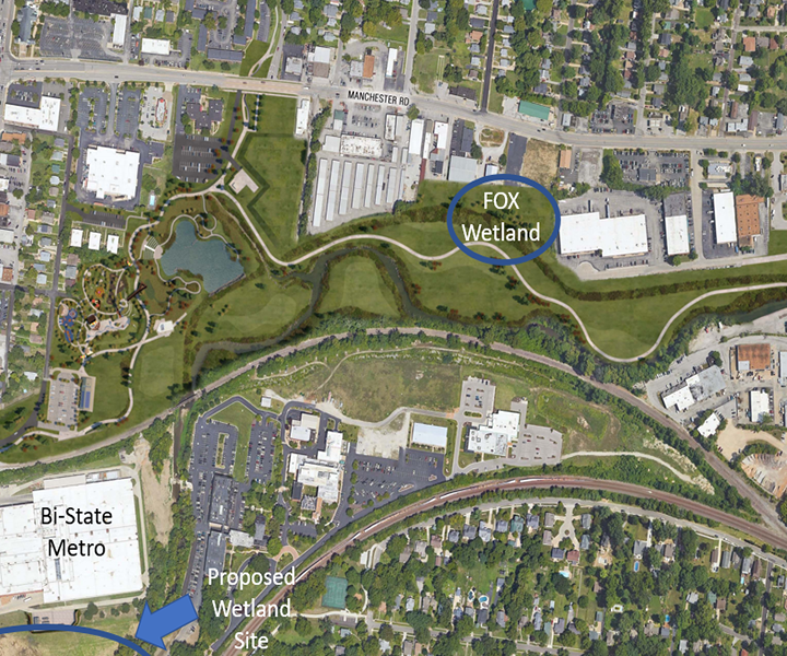
The Brentwood Bound Plan is a comprehensive solution to overcome flooding and public safety challenges presented by the Deer Creek channel and to improve the Manchester Road corridor within the City of Brentwood. Great Rivers Habitat Alliance with support of the Fox Family Foundation is proud to partner with the City of Brentwood in their Brentwood Bound Plan and Deer Creek Flood Mitigation project.
GRHA continues its strategy of partnerships to protect the Confluence through programs such as the Missouri Agriculture Wetlands Initiative, which delivers coordinated private land conservation in the Confluence. GRHA is proud to join the Missouri Agricultural Wetland Initiative (MAWI) Partnership and will support the partnership through an annual gift restricted to projects in the 3 county areas of Lincoln, Pike and St. Charles.
Great Rivers Habitat Alliance has made a commitment to partner with Wisconsin Ducks Unlimited and other partners to support Wisconsin’s Big Rivers Initiative. The Wisconsin Big Rivers Initiative focuses on the western two-thirds of the state that drains into the Mississippi River, down to the Confluence and eventually the Gulf of Mexico.
The Great Rivers Habitat Alliance is proposing the creation of a placed-based partnership designed to increase focus and achieve a shared vision of protecting the Confluence floodplain called the GRHA Revolving Lands Partnership.
Great Rivers Environmental Law Center partners with Great Rivers Habitat Alliance by providing free legal services to protect the environment and public health. We work together through the courts and administrative agencies to safeguard the environment by enforcing environmental laws, especially air and water pollution laws and laws intended to protect wetlands, floodplains, open space, and endangered species.
To address flooding, GRHA is working with local leadership to tackle the issue of floodplain rise and the filling of the floodplain and develop a regional approach for managing flood losses while protecting and restoring benefits of floodplains. We look to grow public awareness of the importance of the Confluence and provide a voice for landowners, agriculture, the duck clubs and Confluence hunters. GRHA will use policy and litigation to support our mission to directly combat the commercial development of the 100-year Confluence flood plain.
"It is vital to protect the critical migration habitat of Raccoon Ranch in perpetuity - especially as it relates to the abundant spring migration habitat on the property,” explained Charlie Hager, President and Chief Operating Officer for C. Hager & Sons Hinge Manufacturing Company. “The more of us in the Confluence who take the step to protect the wetland values of our property with a conservation easement the more we can insure that waterfowl will use the Confluence in the future.”
Garth Fort, then Dardenne Club member and chairman of the club's easement committee said, “The 22-member club voted unanimously to protect Dardenne's natural wetlands with a conservation easement, and we all feel really good in doing so. It's the most important action the club has ever taken.”
“We’re all stewards of the land. It’s our obligation and responsibility to preserve and protect this historical migration route, and that will require all ducks clubs, large and small, working together to conserve the wetland values of the Confluence. Maybe in 200 years someone will say, ‘These folks sure had some foresight!’”
"A donated easement was the best way to guarantee the long-term sustainability of the wetland habitat on the property."