
POLICY – A TRAGEDY FORETOLD: WHY WE MUST STOP BUILDING IN THE 100-YEAR FLOODPLAIN
A Tragedy Foretold: Why We Must Stop Building in the 100-Year Floodplain

The July 4 Guadalupe River flood that devastated Camp Mystic in Kerr County, Texas, was more than a natural disaster—it was a preventable tragedy. At least 129 lives were lost, many of them children, as floodwaters surged through cabins built in a known flood zone. But this was not the first time we’ve seen such devastation. Thirty years ago, the Great Flood of 1993 created similar devastation and sent a similar warning—one we’ve tragically failed to heed.
Echoes of 1993: A River’s Fury Remembered
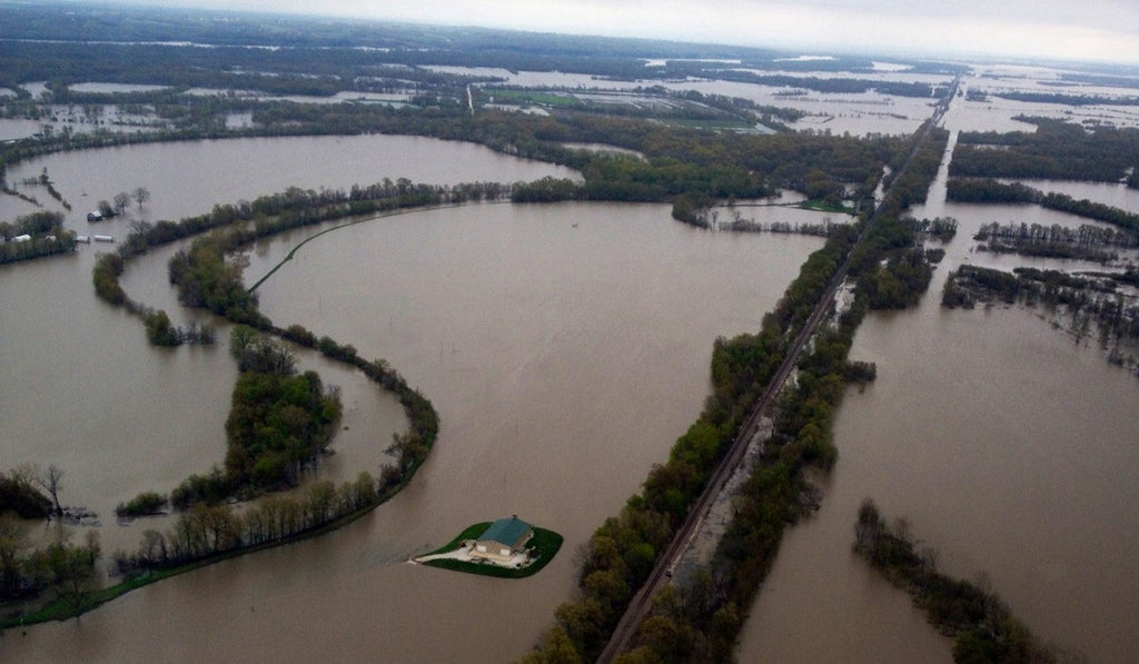
On July 30, 1993, the Mississippi River crested at a record-breaking 49.6 feet in St. Louis, nearly 20 feet above flood stage (1). The flood inundated over 20 million acres across nine states, destroyed 50,000 homes, caused the loss of 50 lives and up to $20 billion in damages (2), (3). It was the costliest and most devastating flood in U.S. history at the time.
Entire towns like Valmeyer and Fults, Illinois, were submerged. Levees failed. Navigation on the Mississippi and Missouri Rivers was shut down for weeks. The river, swollen by months of relentless rain, reclaimed its floodplain with terrifying force. And yet, despite the scale of destruction, development in flood-prone areas continues.
Camp Mystic: A Modern-Day Parallel
Fast forward to 2024. Camp Mystic, located in the 100-year floodplain, had successfully petitioned FEMA to remove dozens of buildings from the flood hazard map. These removals reduced oversight and allowed expansion—right into harm’s way. When the Guadalupe River rose this past July 4th, nearly 16 feet in under an hour, cabins were swept away. Children were trapped. Emergency plans failed.
This is not just a coincidence. It’s a pattern. The same disregard for floodplain science that contributed to the 1993 disaster is still shaping policy today.
The Myth of the “100-Year” Flood
The term “100-year floodplain” is misleading. It suggests rarity, a once-in-a-lifetime event. In reality, it refers to an area with a 1% chance of flooding in any given year. Over the course of a 30-year mortgage, that risk climbs to 26%. And with climate change accelerating extreme weather events, the odds are even worse.
Camp Mystic sat squarely in this danger zone. FEMA’s flood maps had long designated parts of the camp as a “Special Flood Hazard Area,” requiring flood insurance and stricter building codes. Yet over the years, Camp Mystic successfully appealed to FEMA to remove dozens of buildings from the flood map—first in 2013, then again in 2019 and 2020. These removals loosened oversight and paved the way for expansion, even as the camp remained in one of the most flood-prone regions of Texas, known ominously as “flash flood alley.”
Lessons Unlearned
The 1993 flood should have been a turning point. It exposed the limitations of levees, the dangers of floodplain constriction, and the consequences of ignoring nature’s boundaries. Experts warned that the river’s flood-carrying capacity had been reduced by decades of development and levee construction (4). Yet instead of restoring floodways, we built higher levees and pushed further into the floodplain.
Camp Mystic’s tragedy is a direct result of this mindset. FEMA’s map amendment process, which favors property owners over public safety, allowed buildings to remain within feet of the floodplain boundary. The camp’s emergency plan, approved just days before the flood, proved woefully inadequate.
A Floodplain Is Not a Blueprint
Across the country, thousands of structures exist in floodplains—homes, schools, businesses—many built before modern mapping or under outdated regulations. FEMA’s maps, while essential, often underestimate risk. They don’t account for flash floods, small waterways, or climate-driven rainfall patterns. And local governments, under pressure from developers, frequently allow construction in these zones, betting against nature.
A Smarter Path Forward
We must stop repeating history. That means:
- Prohibiting new construction in the 100-year floodplain, especially in areas with flash flood risk.
- Reforming FEMA’s map amendment process to prioritize safety and transparency.
- Investing in updated flood modeling that reflects climate change and extreme weather patterns.
- Restoring natural floodways to give rivers room to breathe and reduce flood heights.
- Educating communities about flood risk and emergency preparedness.
These steps are not just about policy—they’re about protecting lives.
Honor Through Action
The Great Flood of 1993 and the Camp Mystic disaster are chapters in the same story: one of human hubris and nature’s response. They were not acts of God—they were the result of human decisions. Decisions to build in harm’s way. To challenge flood maps. To expand without regard for risk. And to ignore warnings until it was too late.
We have seen what happens when we build in harm’s way. We’ve mourned the losses. Now we must act.
We owe it to the victims to learn from this tragedy. To ensure that no parent ever again receives a call that their child was swept away in a flood that could have been avoided. To treat floodplains not as development opportunities, but as sacred spaces—meant to absorb water, not human lives.
Let the memory of those lost guide us toward a future where floodplains are respected, not exploited. Where rivers are given space to flow safely. And where our children are never again placed in danger for the sake of convenience or cost-cutting.
Let this be the moment we change course. Let the Guadalupe River’s fury be the final warning.
Rivers will rise again. The question is: will we be ready?
1. Great Flood of 1993 - Wikipedia
2. The Great Flood of 1993 | U.S. Geological Survey
3. The Great Flood of 1993 - National Weather Service Heritage - Virtual Lab
4. A Look Back at the Great Flood of 1993 | Missouri Department of Conservation
Related post

08
Jul
07
Jul

06
Jul
06
Jul

06
Jul
RECENT POSTS
06.July.2026
Winchester and GRHA Expand Conservation Partnership to Grow the Next Generation of Hunters
0 Comments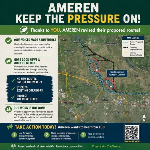
06.July.2026
Standing Together for the Confluence: An Important Update on Ameren’s Transmission Line Proposal
0 Comments